Mohawk Council of Kahnawà:ke Undertakes a Shoreline Vulnerability Assessment
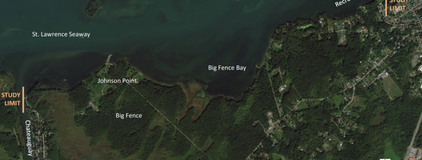
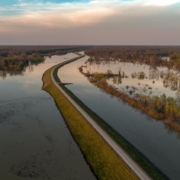
The community of Kahnawà:ke has observed erosion of the natural shoreline over the years, with particularly high-water levels and flooding in 2017. The shoreline and flood levels have also been impacted by interventions in the Great Lakes and the St. Lawrence, including construction of the seaway. With increased variability in weather patterns as a result of climate change, the community has identified a need to plan for rising water levels and shoreline erosion. In the Kahnawà:ke community, erosion & flooding poses a particular threat to houses & properties located directly on the shoreline, but also to fishing & recreation areas and a secondary drinking water inlet pipe location. We proposed to undertake a project that included a shoreline vulnerability assessment with an emphasis on the impact of climate change on shoreline erosion and flooding along the natural shoreline of the St. Lawrence River within the community of Kahnawà:ke.
We partnered with Shoreplan Engineering and with community members to complete the shoreline vulnerability assessment. Shoreplan conducted a technical coastal engineering assessment which included compiling existing data, completing a review of current & historic orthoimagery, conducting site visits to gather & quantify new data, assessing existing erosion control and the proposal of solutions to on-going erosion and flooding. The shoreline vulnerability assessment included both erosion and flood hazard assessments to determine the vulnerability of our community’s shoreline. The erosion hazard assessment allowed us to determine which structures along our shoreline are at risk of erosion in the future. The erosion hazard assessment revealed that the most significant cause of erosion on the studied shoreline was due to wind wave action, particularly at higher water levels. Wake generated by passing ships further contributed to erosion potential. The flood hazard assessment provided flood hazard limits to our community to help direct future development. It was discovered that a 20-year return period west-wind storm occurring at the 100-year water level will cause uprush that will overtop the riverbank and protection structures everywhere along the study area.
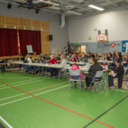
In addition to these field activities, we also hired a community member to conduct public awareness campaigns that addressed climate change in general as well as specifically in relation to this project. The hired community member also distributed a survey to land holders within the project study area to gauge impressions of erosion and flooding on land holder’s properties. Lastly, we hosted an open house event to provide additional information and gather input from the community.
A list of proposed options to address erosion and flooding along the shoreline were provided and tailored to specific reaches of the shore. These methods prioritized ‘soft’ solutions while also outlining the key characteristics for successful implementation of more engineered solutions if an individual landholder choses that approach. Among the natural methods it was suggested to use and enhance vegetation species already present on the landscape to reduce the erosive effects of wave action. This could include the implementation of a planting program with the goal of planting more of these local species of vegetation. Infrastructure solutions discussed included the use of revetments, stacked armour stone walls, bulkheads or seawalls, groynes, breakwaters, and bioengineering alternatives.
Blog post: Mohawk Council of Kahnawà:ke

 Envato Elements (Licensed)
 Yellow Quill First Nation

 Bonnie Kittle (Unsplash)
 Bart Heird (Unsplash)