Posts

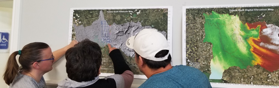
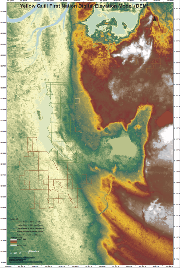
Indigenous-led watershed planning is crucial for Indigenous communities to adapt to the fast pace of climate change. A watershed is a physical area that absorbs rain and snow into underground sources of water, such as, rivers, creeks, and streams, and catches the elements in lakes, oceans, and other bodies of water that are all aboveground. Watershed planning involves the decisions that people make to determine what happens to water in an entire physical region, as well as what happens to it at the local community level.

Target 15 of the 2020 Biodiversity Goals and Targets for Canada states: “By 2020, Aboriginal traditional knowledge is respected, promoted and, where made available by Aboriginal peoples, regularly, meaningfully and effectively informing biodiversity conservation and management decision-making.” Although Indigenous inclusion in state-driven biodiversity planning, such as planning for watersheds, is important, it is not at the heart of Indigenous-led watershed planning.

Values behind Indigenous-led watershed planning, which can include interconnectedness, self-determination, education, and resilience, among others, are what make Indigenous-led watershed planning different from dominating non-Indigenous watershed planning practices. For example, water is a sacred life-source and holds cultural significance for Indigenous peoples. As noted in the First Nations Integrated Watershed Planning guidebook, created by the Centre for Indigenous Environmental Resources (CIER), First Nation-led watershed planning asks different questions than non-Indigenous-led watershed planning – questions such as: “if water is alive and represents life – if we are all connected and embody an ethic of reciprocity in our decisions and daily lives – what would be the different outcomes of a watershed planning process?”

Stewardship is integral to Indigenous-led watershed planning. The National Indigenous Guardians Network (NIGN) is an Indigenous-led and Canadian federally-funded pilot project – a network of Indigenous stewards of the land, water, and ice. Inspired by a similar network of Indigenous environmental stewardship in Australia, the NGIN has engaged in watershed planning projects across Canada. Furthermore, Indigenous communities, on their own, or in partnership with universities, are creating climate adaptation plans that include watershed planning. For example, the Karuk Tribe has created its own Climate Adaptation Plan which includes practices to protect rivers and riverbeds (i.e., riparian practices). Furthermore, the Tribal Climate Tool, a partnership among Indigenous communities, including the Swinomish, and the Climate Impacts Group at the University of Washington, provides data to help Indigenous communities make their own climate adaptation decisions, by including measurements, such as rain fall and temperature.

Indigenous-led watershed planning can strike a balance among diverse cultural values, as well as needs of the natural environment, and of Indigenous communities. Some communities may consider including economic development priorities in their watershed plans too, such as energy conservation and generation projects, while protecting Traditional Ecological Knowledge (TEK). Climate adaptation plans that are rooted in both present needs and values and future aspirations, enable Indigenous communities to adapt to environmental changes as they happen, and hold the potential to enable Indigenous people to adapt to climate change better than ever before.


By Leela Viswanathan

Researchers and Community looking at maps of flooding events

(Image: Researchers and community members looking at maps of flooding events in YQFN)

Introduction:

Being no stranger to threats from climate change through growing up with constant flooding, forest fires, and extreme weather overwhelming his community, Myron Neapetung, a Councilor at Yellow Quill First Nation, had an idea to help his community be better prepared for the future. Over the years, he had built relationships with the University of Saskatchewan, and felt like it was time to start gathering the Elders’ stories and working with scientists on climate change concerns so that ongoing problems could finally be resolved. In May 2018, together with Lori Bradford, an Assistant Professor in the School of Environment and Sustainability at the University of Saskatchewan, Myron launched a First Nations Adapt Program grant to look at their community’s vulnerability to more frequent flooding brought on by the effects of the climate emergency.

The project had four main parts. Looking back through records at the Band office, and the urban services office in Saskatoon, Myron realized that the community was short on record keeping and mapping capacities, so the first step was to contract LiDAR services (Light Detection and Ranging, a remote sensing method that uses a pulsed laser to measure ranges) for the entire watershed. With this very detailed information about the elevation of the land around the reserve, computer modelers at the University of Saskatchewan were able to put together risk maps and put these maps into models that predict flooding. The community was presented with maps that showed where water would likely go if there were a variety of storms, like 50- and 100mm flooding events. Elders and knowledge holders in the community verified these maps to help the computer modelers improve their accuracy. With a shortage of LIDAR available in Saskatchewan, the University-based modelers were very grateful to be involved in this work and learning from those experiencing flooding was incredibly valuable to them.

Picture 1: LIDAR DEM Map showing elevation

lidar map

The second step involved bringing people, young and old, from the community together to talk about flooding. That involved many community meetings in the summer of 2018, interviews with Elders and knowledge holders, projects with school students, and sharing circles. We also used a variety of other data gathering techniques like drawing and taking pictures of flood effects, going on extensive community tours, hosting poster sessions for feedback on any information gathered already, and enjoying many community lunches together. Myron, University students, and the researchers then analyzed the combined data from these activities and made posters and presentations to share with the community and other researchers at conferences.

Picture 2: Community meeting with posters

Community meeting with posters

The third step involved hiring three summer students in the community to look at the emergency management planning documents, and talk with emergency personnel, such as firefighters, road crews, water treatment officers, Chief and Council members, health care workers, wellness center staff, and others involved during emergencies. These students catalogued everyone’s ideas to improve emergency plans in the case of flooding. The three summer students are in the middle of summarizing their results and comparing them to what is written in the official documents.

Picture 3: Photo of records of previous work on flood engineering

Flood engineering

The last step for the vulnerability assessment was to invite some engineering experts to do an infrastructure assessment in the community to give a thorough review of important infrastructure that is at risk from ongoing flooding. The First Nation PIEVC Infrastructure Resilience Toolkit process will be occurring August 19-23rd in Yellow Quill with the assistance of the Ontario First Nations Technical Services Cooperative, Stantec Inc., and the Saskatchewan First Nations Technical Services Co-operative.

Picture 4: Where the water will go for certain flood events

Yellow Quill FN Watershed


The overall goal is to learn about the vulnerabilities of Yellow Quill First Nation so informed decisions about how to prepare for a future of unpredictable climate-related challenges can be made in a way that respects community-held knowledge and experience while also harnessing some of the hydrological modelling sciences to predict how climate change might affect daily life. This first climate change adaptation opportunity has spearheaded YQFN’s involvement in a number of research projects around water at the University of Saskatchewan and farther afield in Canada, and has provided a lot of capacity building opportunities for people from Yellow Quill to learn more about climate change, floods, research, and emergency management.


Authors: Myron Neapetung, Yellow Quill First Nation and Lori Bradford, University of Saskatchewan