A recent study by researchers at the University of Waterloo examines flood risk as a climate change effect and its complex connection to socio-economic and population factors (or “social vulnerability”) in both Indigenous and non-Indigenous communities in Canada. The study concludes that while the percentage of Indigenous and non-Indigenous residences exposed to flood hazards is roughly the same, the numerous challenges facing Indigenous communities, as an impact of land dispossession and colonization, means “the overall risk of Indigenous communities is higher.”

The peer-reviewed study compares “flood risk between Indigenous communities on 985 reserve lands and other Canadian communities across 3701 census subdivisions” and integrates an analysis of “socio-economic, demographic, ethnic, and cultural characteristics.” Eighty-one percent of the Indigenous communities in the study were exposed to flood hazards which would impact either their land and residences or the overall population.

Typically, flood hazards are categorized as primary, secondary, or tertiary. Primary hazards are associated with flooding where there is direct contact with water (e.g., erosion of soil, buildings, and other infrastructure; water damage to buildings; flooding of farmlands resulting in crop loss; human and animal drownings). Secondary flood hazards are the result of the primary hazards and can include toxic pollutants released by garbage and backed-up debris in sewage drains (i.e., the debris being a primary effect), as well as numerous health effects and service disruptions. Tertiary flood hazards are the long-term effects of primary and secondary flood hazards.


By Leela Viswanathan


(Photo credit: Justin Wilkens, Unsplash)

The Alberta provincial government has released draft flood maps meant to improve public safety, support emergency management, and help build safer and more resilient communities over the long term. Engagement opportunities are open for Albertans to provide feedback on new flood maps. Feedback will help ensure this work is technically sound. Share your thoughts on the draft flood maps by going to https://www.alberta.ca/flood-study-engagements.aspx by January 15, 2021.

The engagement for these studies is part of an initiative that developed 18 new provincial flood studies, covering over 1,500 kilometres of river through more than 60 municipalities and First Nations, including the five following First Nations:

New flood maps are available for many communities across Alberta. You do not need to be an engineer or flood expert to view or provide feedback. The Alberta provincial government will carefully consider all feedback received and will revise the draft reports and flood maps to address technical errors, as appropriate.


Information from: Government of Alberta, Ministry of Environment and Parks.


(Photo Credit: Joshua Woroniecki , Unsplash)


Since 2013, the Mi’kmaq Confederacy of Prince Edward Island (MCPEI) has supported the communities of Lennox Island and Abegweit First Nations in preparing and adapting to climate change impacts.

Recent studies have shown that climate change is contributing to sea-level rise, coastal erosion, and increased storm surges on Prince Edward Island, putting communities such as Lennox Island at risk. Coastal residences, critical community infrastructure, sacred grounds, and medicinal plant sites are all under threat from climate change and we needed to prepare for these challenges.

Having the community identify their priorities and concerns has been integral to the success of this project. We hosted workshops with Lennox Island and Abegweit First Nations to identify and prioritize key climate risks to the community. Issues related to emergency response and human health, vulnerability of infrastructure, sea-level rise, coastal flooding, and vulnerability of traditional fishing and hunting areas were identified as key concerns by the community. “Climate change adaptation and the protection of our home, Lennox Island, is one of the most pressing challenges we face today” stated Chief Darlene Bernard of Lennox Island First Nation. “We appreciate the partnerships that have formed to help us achieve that goal.”

We also partnered with the University of Prince Edward Island’s Climate Land and Simon Fraser University’s Spatial Interface Research Lab on the Coastal Impact Visualization Environment (CLIVE). CLIVE combines historical erosion data, model projections of sea-level rise, aerial imagery, and high-resolution digital elevation data to draw map out coastal erosion and future sea-level rise scenarios. By using 3D game engine technology, CLIVE is able to communicate climate change information to community members that is visual and easy to understand.

We are planning future activities that will include continued community consultations, development of an archeological climate change risk assessment tool, and training on how to operate UAVs for community members. Our project will culminate in the development of an adaptation plan that will help our communities improve their resiliency to climate change.

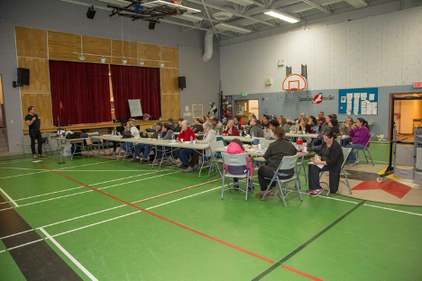
Caption: Audience at Lennox Island (PEI) attending community workshop on climate change


Blog Post from: Mi’kmaq Confederacy of Prince Edward Island

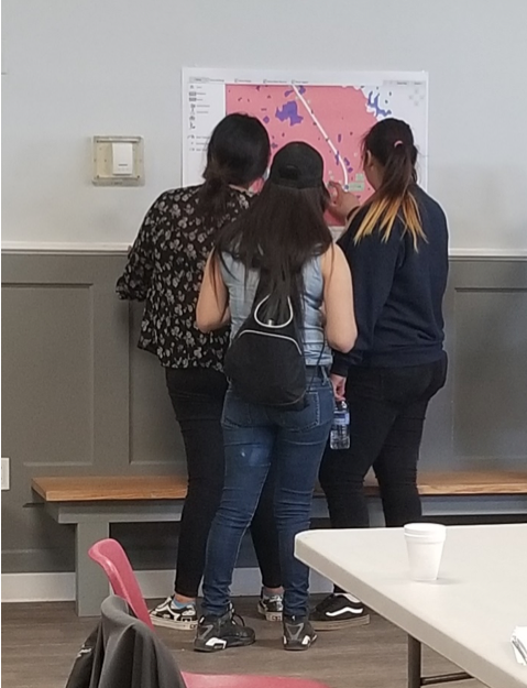
Researchers and Community looking at maps of flooding events

(Image: Researchers and community members looking at maps of flooding events in YQFN)

Introduction:

Being no stranger to threats from climate change through growing up with constant flooding, forest fires, and extreme weather overwhelming his community, Myron Neapetung, a Councilor at Yellow Quill First Nation, had an idea to help his community be better prepared for the future. Over the years, he had built relationships with the University of Saskatchewan, and felt like it was time to start gathering the Elders’ stories and working with scientists on climate change concerns so that ongoing problems could finally be resolved. In May 2018, together with Lori Bradford, an Assistant Professor in the School of Environment and Sustainability at the University of Saskatchewan, Myron launched a First Nations Adapt Program grant to look at their community’s vulnerability to more frequent flooding brought on by the effects of the climate emergency.

The project had four main parts. Looking back through records at the Band office, and the urban services office in Saskatoon, Myron realized that the community was short on record keeping and mapping capacities, so the first step was to contract LiDAR services (Light Detection and Ranging, a remote sensing method that uses a pulsed laser to measure ranges) for the entire watershed. With this very detailed information about the elevation of the land around the reserve, computer modelers at the University of Saskatchewan were able to put together risk maps and put these maps into models that predict flooding. The community was presented with maps that showed where water would likely go if there were a variety of storms, like 50- and 100mm flooding events. Elders and knowledge holders in the community verified these maps to help the computer modelers improve their accuracy. With a shortage of LIDAR available in Saskatchewan, the University-based modelers were very grateful to be involved in this work and learning from those experiencing flooding was incredibly valuable to them.

Picture 1: LIDAR DEM Map showing elevation

lidar map

The second step involved bringing people, young and old, from the community together to talk about flooding. That involved many community meetings in the summer of 2018, interviews with Elders and knowledge holders, projects with school students, and sharing circles. We also used a variety of other data gathering techniques like drawing and taking pictures of flood effects, going on extensive community tours, hosting poster sessions for feedback on any information gathered already, and enjoying many community lunches together. Myron, University students, and the researchers then analyzed the combined data from these activities and made posters and presentations to share with the community and other researchers at conferences.

Picture 2: Community meeting with posters
Community meeting with posters

The third step involved hiring three summer students in the community to look at the emergency management planning documents, and talk with emergency personnel, such as firefighters, road crews, water treatment officers, Chief and Council members, health care workers, wellness center staff, and others involved during emergencies. These students catalogued everyone’s ideas to improve emergency plans in the case of flooding. The three summer students are in the middle of summarizing their results and comparing them to what is written in the official documents.

Picture 3: Photo of records of previous work on flood engineering
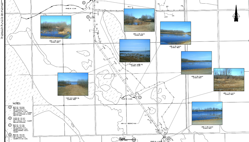
Flood engineering

The last step for the vulnerability assessment was to invite some engineering experts to do an infrastructure assessment in the community to give a thorough review of important infrastructure that is at risk from ongoing flooding. The First Nation PIEVC Infrastructure Resilience Toolkit process will be occurring August 19-23rd in Yellow Quill with the assistance of the Ontario First Nations Technical Services Cooperative, Stantec Inc., and the Saskatchewan First Nations Technical Services Co-operative.

Picture 4: Where the water will go for certain flood events

Yellow Quill FN Watershed


The overall goal is to learn about the vulnerabilities of Yellow Quill First Nation so informed decisions about how to prepare for a future of unpredictable climate-related challenges can be made in a way that respects community-held knowledge and experience while also harnessing some of the hydrological modelling sciences to predict how climate change might affect daily life. This first climate change adaptation opportunity has spearheaded YQFN’s involvement in a number of research projects around water at the University of Saskatchewan and farther afield in Canada, and has provided a lot of capacity building opportunities for people from Yellow Quill to learn more about climate change, floods, research, and emergency management.


Authors: Myron Neapetung, Yellow Quill First Nation and Lori Bradford, University of Saskatchewan

Across the Interlake region in Manitoba, the impacts of a changing climate are being experienced more frequently than in previous years. Compounding this conundrum is the severity of the impacts. Take for example, as a result of severe flooding, several First Nations Communities, who are usually the most affected, were evacuated in 2011 and 2014. Climate colonialism – where the least resilient are shouldered with the responsibility of bearing climate impacts – is another challenge many First Nations communities face. To illustrate, constant water regulation has impacted the Fairford River in Pinaymootang First Nation, a once pristine riparian zone. The flora and fauna have been deeply impacted. “This was once a spawning area for Northern pike. Now, fish cannot be caught by shoreline and rod fishing anymore (rare a fish is caught)”, a community member said.  This change did take not place suddenly, it happened over a period of time – like a slow-moving emergency.

To address some of these issues, Interlake Reserve Tribal Council – a consortium of six First Nations Communities working together to advance the collective wellbeing of its members – utilised a community participatory approach that integrates indigenous knowledge in the process of formulating long term adaptation plans that are unique to each community. First, adaptive capacity measurements and increasing adaptive capacity: Sessions were designed to allow community members to discuss issues and potential solutions and for the project to gather more information. And at treaty days, throughout the summer of 2018, the project had a booth set up (In each community) for further discussions and information sharing. Pre-liminary results indicate that close to 100% of community are aware of climate change and its effect, but are convinced that communities do not have adequate resources in place to tackle these impacts. Second, Community Risk Mapping: Using a participatory approach that integrates traditional knowledge in adaptation planning, climate risks maps were produced. Community members, including leaders, resource users (hunters, fishermen.), and elders, were selected in the various mapping sessions organized. Oral stories and transect walk, in addition to qualitative assessments, were used to identify and assess climate hazards and its level of impact. These data were put on the physical map provided, and later converted into GIS layers.

Third, hazard inventory and risk analysis: Together with IRTC’s emergency management team, the project carried out a preliminary risk analysis of hazards in each community. Stakeholder engagement sessions and site visits to each of the six IRTC First Nations were conducted to acquire local knowledge and context regarding hazards and risks as they applied to individual communities. These engagement sessions included interviews and meetings with Elders and interested community members – all geared towards providing a suitable foundation for adaptation.

As can be seen, IRTC’s project has begun the process of building uniformity of perceptions/views among stakeholders, prioritizing each community’s issues, investing in capacity building, and exploring solutions.  And the one thing, though, that all communities agree on, is that continued action is required combat this slow-moving threat.


Author: Interlake Reserve Tribal Council