Since 2013, the Mi’kmaq Confederacy of Prince Edward Island (MCPEI) has supported the communities of Lennox Island and Abegweit First Nations in preparing and adapting to climate change impacts.

Recent studies have shown that climate change is contributing to sea-level rise, coastal erosion, and increased storm surges on Prince Edward Island, putting communities such as Lennox Island at risk. Coastal residences, critical community infrastructure, sacred grounds, and medicinal plant sites are all under threat from climate change and we needed to prepare for these challenges.

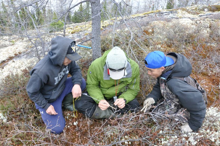
Having the community identify their priorities and concerns has been integral to the success of this project. We hosted workshops with Lennox Island and Abegweit First Nations to identify and prioritize key climate risks to the community. Issues related to emergency response and human health, vulnerability of infrastructure, sea-level rise, coastal flooding, and vulnerability of traditional fishing and hunting areas were identified as key concerns by the community. “Climate change adaptation and the protection of our home, Lennox Island, is one of the most pressing challenges we face today” stated Chief Darlene Bernard of Lennox Island First Nation. “We appreciate the partnerships that have formed to help us achieve that goal.”

We also partnered with the University of Prince Edward Island’s Climate Land and Simon Fraser University’s Spatial Interface Research Lab on the Coastal Impact Visualization Environment (CLIVE). CLIVE combines historical erosion data, model projections of sea-level rise, aerial imagery, and high-resolution digital elevation data to draw map out coastal erosion and future sea-level rise scenarios. By using 3D game engine technology, CLIVE is able to communicate climate change information to community members that is visual and easy to understand.

We are planning future activities that will include continued community consultations, development of an archeological climate change risk assessment tool, and training on how to operate UAVs for community members. Our project will culminate in the development of an adaptation plan that will help our communities improve their resiliency to climate change.

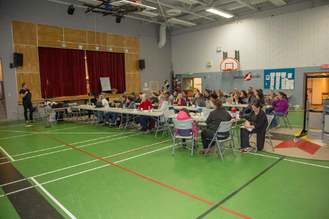
Caption: Audience at Lennox Island (PEI) attending community workshop on climate change


Blog Post from: Mi’kmaq Confederacy of Prince Edward Island

The Imalirijiit (Those who study water in Inuktitut) Program began in 2016 following a partnership between local organizations in Kangiqsualujjuaq (Nunavik, Quebec), and a group of university-based researchers. Kangiqsualujjuamiut were concerned about the possibility of a rare earth elements (REE) mining project starting its operations in the upper watershed of the George River (Strange Lake). The George River is essential to the traditional activities of fishing, hunting and gathering and the community wanted to start its own long-term community-based environmental monitoring program to collect baseline (or reference) data before any mining activities impact the water and environment quality in the watershed.

The Imalirijiit program includes Science land camps (Nunami Sukuijainiq), training workshops, and biomonitoring of atmospheric, aquatic and terrestrial conditions in the George River watershed, as well as interactive mapping of land use and local knowledge.

The community aims to track changes in its changing environment, especially by involving the youth in environmental stewardship. Among other things, they are studying the evolution of vegetation over the last 50 years in the river’s watershed. They are also developing a component for monitoring the abundance and characteristics of locally available shoreline country food species (Tininnimiutait), such as seaweeds (kuanniq), mussels (uviluq), clams (ammuumajuk) and other animals that are harvested or that provide a food source for the harvested species in Nunavik marine waters. This new aspect aims to enhance the dietary quality of these organisms and improve our food security and sovereignty.

Imalirijiit intends to stimulate interests toward science, and provide scientific educational and training opportunities for youth and other community members, through a land-based and hands-on approach. It also fosters intergenerational and intercultural knowledge exchanges and provides local jobs (see Figure 1).

Figure 1. Objectives of the Imalirijiit Program.

Figure 2. 2019 Science Land Camp.

Figure 3. Collection of macroinvertebrates in the sediments at the bottom of a small tributary of the George River.

Figure 4. Collection of lichens for monitoring the air quality.

Figure 5. Tree coring to characterize the tree population (e.g. age and growth).


Look at our 2019-2020 report!
IMALIRIJIIT and NUNAMI SUKUIJAINIQ – Winter 2020. Results Summary for Community Organizations and Contributors.
https://drive.google.com/file/d/1WfWKju-C-QiZ9mGxe96hEYZEuLLEozWK/view?usp=sharing

Watch our videos!
NUNAMI SUKUIJAINIQ, 2020. Short documentaries series about the 2019 Science Land Camp on the George River, Nunavik.
10 minutes version: https://youtu.be/5MxC73SW-pw
4 minutes version: https://youtu.be/EUhdCs7Aodg
1-minute trailer: https://youtu.be/Qdmi9katTQg

Visit our websites!
http://www.imalirijiit.weebly.com
http://www.nunamiskuijainiq.weebly.com


Article By: The Imalirijiit Team, June 2020.